
Numerous rivers in Brisbane are famous for their beauty and soulful views. These rivers are a significant tourist attraction. Almost all the rivers are historical. However, the city of Brisbane has an extensive network of river systems.
1. Famous Rivers In Brisbane – Top 9 Rivers To Know About!
Following are the nine famous rivers in Brisbane. To know in detail, let’s go through the information given below:
1.1. Brisbane River
The Brisbane River streams through the Eastern side of Brisbane. It is South East Queensland’s longest river in Australia. It empties into its mouth Moreton Bay, located on the Coral Sea.
However, the river is named after Sir Thomas Brisbane. He was the Governor of New South Wales.

The name was given to it in 1823 by John Oxley. He was the first European Explorer of the Brisbane River. However, the origin of the name is Scottish. Eventually, it became the former name that the government of Queensland uses to address it. Later, Moreton Bay’s panel colony acquired the name from the river and became the current Brisbane city.
Meanwhile, it is also named Maiwar. This name is given by aboriginal people native to the Brisbane area in their Turrbal language. Further, this river has two branches. The first is the East, and the second is the West branches. Initially, these branches have their headwaters that are present in the Kingaroy’s east.
Moreover, the East and West branches combine at Mount Stanley’s watercourse to the south. However, the river’s source is situated on the upper side of the Bunya Mountains. These are the headwaters of Cooyar Creek. It is the longest tributary of the Brisbane River.
Following are the tributaries of the Brisbane River to the north:
- Stanley River
- Breakfast Creek
- Moggill Creek
Following are the tributaries that enter the Brisbane River from the South:
- Lockyer Creek
- Bulimba Creek
- Oxley Creek
- Norman Creek
- Bremer River
Given below are some of the minor tributaries of the river:
- Wolston Creek
- Pullen Creek
- Cressbrook Creek
- Goodna Creek
- Kholo Creek
1.2. Breakfast Creek

The Breakfast Creek is a small river in the suburban region of Brisbane, Queensland, Australia. It is one of the tributaries of the Brisbane River. Initially, it evacuated D’Aguilar Range as Enoggera Creek. It is in the D’Aguilar National Park. Closer to the Herston, it became Breakfast Creek.
It streams about two kilometres from here before blending into the Brisbane River at Newstead. Breakfast Creek is the first river that joins the Brisbane River from its northern banks.
In 1824, Allan Cunningham and John Oxley met with members of the native Aboriginal clan. They met at the creek’s mouth.
A minor conflict happened when one of the aboriginal members took a hat of John when they were having breakfast. So, John Oxley named this river to commemorate that incident. Around the 1860s, Breakfast Creek was occupied by a significant aboriginal camping ground. Later, it was dismantled by the police raids.
This camp was among the significant sources for Aboriginal people. They supplied fish to the Moreton Bay colony.
The Breakfast Creek became the source of water transfer during dry times in the former colony of Moreton Bay. It was when the Roma Street Reservoir’s water was drained.
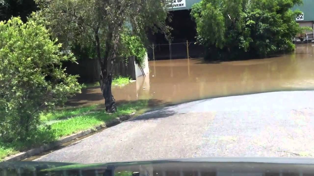
In 1893, 1974, & 2011, many nearby streets of Breakfast Creek collapsed during the Brisbane flood. These numerous floods collapsed various bridges across the creek. In 1858, the first bridge was constructed using ironbark. Later, the 2nd bridge was built with metal in 1889. However, the third, more significant, more persistent bridge was constructed with concrete in 1958.
1.3. Bremer River
One of the Brisbane River’s tributaries is the Bremer River. It resides in the southeast regions of Queensland, Australia. However, the entire length of the river is 100 kilometres.
On September 19, 1824, Allan Cunningham and John Oxley were the European explorers who visited this river together. Initially, John Oxley named this river as Bremer’s Creek.
The river of Bremer rises from the Scenic Room’s hills. Further, it streams through Rosewood town and passes from Ipswich city. Moreover, the Bremer River has numerous tributaries. It includes Reynolds Creek, Franklin Vale Creek, Deebing Creek, Western Creek, Purga Creek, Warrill Creek, and Bundamba Creek.
According to The Queenslander of Brisbane, from 1866 to 1939, the river was named The Urarrar in the Yugararpul Language. When John Oxley returned with Allan Cunningham, another party camped where the river flowed to its mainstream. It happened six days after they had been gone.
John Oxley named this river Bremer River, but he never specified the origin of the name. However, the term is believed to be derived from James Gordon Bremer. He was the HMS Tamar’s naval officer. So, to honour him, the name is given to the river.
When the watershed was settled, the waste from industries streamed into the river. An engineer suggested cutting down trees that are closer to the river. When these trees fall into the water, they take the soil into the river. It makes the river messy and muddy for the streamers. Moreover, the river has seven tributaries, two from the left and 5 to the right.
1.4. Norman Creek
Norman Creek is one of the small tributaries of the Brisbane River. However, the headstreams of the creek are situated on Mount Gravatt and Toohey Mountain’s northern slopes. These mountains are located in Brisbane, Queensland, Australia. Further, the name originated from an alteration of the Gorman’s Creek.
Gorman’s Creek is named after Moreton Bay’s last commander, Lieutenant Gorman. However, the name Norman Creek was given by Edmund Lockyer in 1825. Further, Norman Creek evacuates the Holland Park West and Tarragindi suburbs.
Later, it streams toward the North. From here, it passes through Eastern Brisbane, Greenslopes, and Norman Park. Afterwards, the creek flows into the Brisbane River at Humbug Reach.
The total watershed of the river is spread over an area of 29.8 square kilometres. In Coorparoo, the Coorparoo is Norman Creek’s sub-watershed. Furthermore, Ekibin Creek is the tributary from the right, whereas Sandy Creek is the tributary from the left. Moreover, across the creek, there are four remarkable bridges.
It began from the source of Toohey Mountain and ends at its mouth, the confluence with Brisbane River in East Brisbane. The BCC – Brisbane City Council has recently made a plan known as Norman Creek 2026. This plan is developed for the watershed of the creek. However, genuine auctioning and societal feedback are essential for a better ecosystem.
To make this river better resistant to flooding, BCC declared a funding plan of 14.5 million dollars in March 2011. Upgrading the landscape around the river was also part of this funding plan. The Stones Corner’s Eastern Busway is located over the creek.
1.5. Caboolture River
The Caboolture River resides in South East Queensland, Australia. This small river began below the Campbell Pocket. It is located closer to the Ocean View. Usually flowing to the east, it combines with the two minor tributaries. Further, it streams through the Caboolture, Rocksberg, and Morayfield.
Afterwards, it joins with Moreton Bay’s Deception Bay, located southwards of Beachmere. Its entire course is 46 kilometres long. Further, it has an overall watershed area of 468 square kilometres. However, it facilitates no dams on the watershed. Also, the only primary crossing on the river is the Bruce Highway Bridge.

Furthermore, the Caboolture River falls for around nineteen kilometres upriver to the Caboolture Weir. But, a sand bar reduces the upriver flow at the mouth of the river. However, the rise in urbanization around the watershed threatened the river’s environment. The D’Aguilar National Park conserves the watershed at the upper parts of the river.
Meanwhile, the river’s lower parts are in the Moreton Bay Marine Park. Further, the Caboolture River is a matter of flash flooding along with Pine River & its tributaries. Floods could be the reason for the significant damage to the private and public properties throughout the catchment. For instance, major flooding events were reported in 1967, 2015, 1989, 2011, 1972, 2013, 1974, and 1991.
The traditional guardians of the watershed area of the Caboolture River are the Kabi Indigenous people.
1.6. Oxley Creek
Oxley Creek is another tributary of the Brisbane River. It is situated in the suburbs of Brisbane, South East Queensland, Australia. It began from the Scenic Hills Region’s lower hills. Also, it has a large watershed area of 260 square kilometres. Flowing through Logan City’s western parts, it enters the Brisbane River.
It is the longest creek in Brisbane and the only sand-based creek in the city. From Mount Perry’s northern slopes, the headwaters of Oxley Creek begin. It is located south of Ipswich in the Scenic Rim region. Further, it streams toward the North for around seventy kilometres. Eventually, at the Tennyson, it drains into the Brisbane River.
Following are the tributaries of the Oxley Creek:
- Little Doris Creek
- Crewes Creek
- Moolabin Creek
- Rocky Water Holes Creek
- Sheep Station Gully
- Blunder Creek
- Stable Swamp Creek
The upper catchment of Oxley Creek is quite natural and is less populated. The river’s surroundings are filled with forested hills and beautiful land. Meanwhile, the impact in other regions of the catchment of urban development is high.
Further, in the lower and middle catchment, the tributaries and Oxley Creek stream through twenty-eight suburbs of Brisbane.
These suburbs include Moorooka, Corinda, Sunnybank Hills, Sherwood, Rocklea, and Forest Lake. Moreover, the Algester, Durack, Salisbury, Darra, Graceville, Coopers Plains, and Acacia Ridge are also included. The Logon Motorway and Ipswich Motorway cross Oxley Creek. Further, the entire length of the river is 70 kilometres long.
1.7. Bulimba Creek
Bulimba Creek is an everlasting stream in the suburbs of Brisbane, South East Queensland, Australia. It is the tributary of Brisbane River, formerly known as Doughboy Creek or Doboy Creek.
The sources of the Bulimba Creek catchment lie in lower plateau regions. Further, its sources are Runcorn and Sunnybank from the west catchment, and Kuraby is the east catchment.
From here, it streams towards the North and goes through the Murarrie, Mansfield, Lytton, Carindale, and Mackenzie suburbs. Through the Aquarium passage located with the Lytton Reach, it enters the Brisbane River. However, Bulimba Creek has six tributaries.
Following are the tributaries of Bulimba Creek:
- Tingalpa Creek
- Mimosa Creek
- Lindum Creek
- Salvin Creek
- Spring Creek
- Phillips Creek
There are numerous wetland regions along the river catchment. Lindum Wetlands, Tingalpa Wetlands, Numgubbah Wetlands, and Doboy Wetlands are in the lower catchment. Meanwhile, the Runcorn Wetlands is in the upper catchment.
However, the creek is affected by industrial and urban development. Previously, the stream’s corridor was ultimately cleared for grazing and cropping. The catchment of the Creek falls under the nature reserve network. It has many protected areas, including hills, Mt Gravatt Outlook, Pine Mountain, and Oates Hill.
Moreover, Toohey Forest Conservation Park, Seven Hills, Whites Hill, and Belmont Hills are also included. Tilapia is a meddlesome fish species that is found in waterways. Also, there are many threatened species in various nature reserves.
1.8. Loders Creek
The Loders Creek is a tidal creek and a stream. It flows via the Gold Coast suburbs in South East Queensland, Australia. However, the entire length of the creek is 8.3 kilometres long. Also, it forges a segment of The Broadwater estuary catchment region.
This creek is forged from the two unnamed small streams that intersect west of Southport. Both the tributaries of Loders Creek have been altered to serve stormwater drainage.
The drainage is given for Ashmore’s suburb. Further, it primarily consists of concrete-lined channels. However, the tributary to the north has several areas of natural media.

It also includes the channel morphology of pool-and-riffle—afterward, the creek streams to the northeast from the confluence of both tributaries. Along the way, it borders with the Southport State High School. From here, it flows under the Gold Coast Highway and reaches the Broadwater at Len Fox Park. This park lies between Labrador and Southport.
However, the creek’s drainage basin resides between the Nerang River from the south and Biggera Creek from the north. An official community catchment management group was formed for the first time.
It was primarily for Loders Creek on the Gold Coast. From 1994 onwards, this group also developed a butterfly garden and nature trail. However, the group was initially created only for the creek’s betterment.
In addition, they also developed education resources related to Loders Creek. It also has done restoration work and many surveys related to wildlife in the catchment.
1.9. Enoggera Creek
The Enoggera Creek streams via Brisbane City lie in southeastern Queensland, Australia. It began from the Enoggera Reservoir’s suburbs on the D’Aguilar Range. At last, it ends in the Brisbane River. From Mount Nebo’s southern slopes, the headwaters of the creek form. It resides in the Brisbane Forest Park.
An Enogerra Dam was built within the Enogerra Reservoir’s suburbs. Afterward, it flows in the southeast direction, through the suburbs of Brisbane, while leaving the parklands untouched. It goes via the suburbs of Herston, The Gap, Bowen Hills, Alderley, and Kelvin Grove. Moreover, the Ashgrove, Red Hill, Windsor, Newmarket, and Wilston suburbs are also included.

Furthermore, Enoggera Creek is being restored and redeveloped. This work is being done by the Save Our Waterways Now community organization. High flooding occurred along this creek during the major floods in 1893 and 1974. The flood caused high property and life damage and ruined numerous houses.
However, the flood in 1974 is known as the 1974 Brisbane Flood, which is also one of the significant historical floods. Further, the mouth of the creek is the Breakfast Creek.
2. Conclusion
Brisbane is known for having the Brisbane River. It is the longest river that lies in South East Queensland, Australia. Many of the rivers mentioned above are tributaries of the Brisbane River. A river system is vital to the city and the entire state or country. Further, the Brisbane River passes across the city of Brisbane. It makes the environment chilly here.
There are many prominent rivers in Brisbane which are ecologically important. Mentioned above are the famous and significant rivers in Brisbane. Many creeks, rivers, and tributaries have a long way before they finally reach their destination.
These help make the soil fertile. Henceforth, rivers are an excellent advantage for any city. Ecologically, rivers are incredibly significant. The importance of rivers and vast river systems is numerous for humans. Also, many famous bridges are built over these rivers to serve as a means of transportation.
Last Updated on February 29, 2024 by Maity


your article provides a comprehensive and engaging guide to the rivers of Brisbane, effectively showcasing their beauty and adventure potential. The mentioned additions could further enrich the information by offering visual aids, transportation suggestions, seasonal considerations, and personal insights.